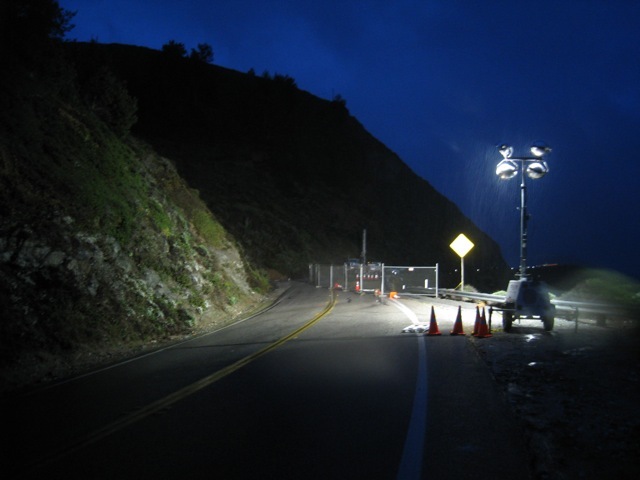
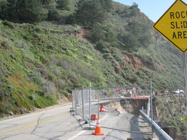
"Road out just south of Rocky Creek..."
One thing about the coast highway collapsing is that it can carry you back into the road's history and give you a faint glimpse of what pre-highway life on the coast must have been like. No matter how economically dependent on the coast highway most residents now are, there is almost always a simultaneous sigh of relief as the road shuts down, and the coast, humanly speaking, becomes quieter and more inward — and more neighborly, too, as people are reminded of how ultimately dependent upon one another we still are.
That is, combined with economic worries, most of us also become deeply grateful for the reminder of why we're really here.
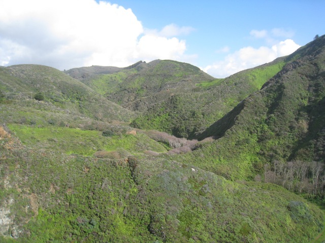
The coast trail, and then the wagon road, wound down into every canyon — and then climbed back out again. This is a view from standing on the current Rocky Creek bridge looking back upcanyon. The old wagon road used to run more or less at the contour of the current phone line. It then descended into the canyon and climbed up the saddle just below Division Knoll.
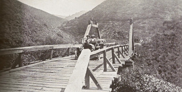
 Courtesy Franklin Peace. Image appears in "Big Sur" by Jeff Norman and the Big Sur Historical Society (93).The above is one of the iterations of the wooden bridge across Rocky Creek. You can see that it crosses much upcanyon of the current concrete highway bridge.
But when the highway was built — since it was intended to be scenic — it hugged the coast (with the exception of the Big Sur river valley) no matter how vertical that coast was.
 Courtesy Pat Hathaway. Image appears in "Big Sur" by Jeff Norman and the Big Sur Historical Society (96).
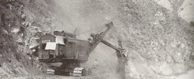
If this photo of a steam-shovel building Highway 1 wasn't taken at the exact spot of the current slide, it easily could've been. Notice a couple things in the photograph. First of all, notice the integrity of the slope above the road ahead of the steam-shovel compared to the slope above where it has already passed. Secondly, notice the side-casting being done. Jeff Norman's caption to this photograph includes this sentence: "Here, an operator side-casts the overburden, thus building up the outer edge of the roadway."
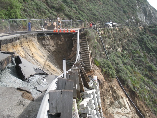
One thing that strikes you at the slide is how much of the highway here was built upon just such fill. Big Sur Kate reports that the cribbing you see dates back to "the original convict construction in the 30′s." I heard another report that it dates back to the 1980's — when this stretch was also sliding. (Xasáuan Today has posted on the 1983 slides in this same vicinity).
But whenever this cribbing was put in, it hardly seems well grounded.
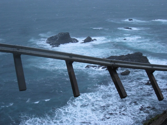
And the posts for the guard railing pulled out as clean as toothpicks.
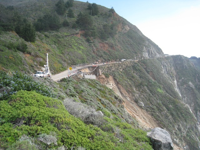
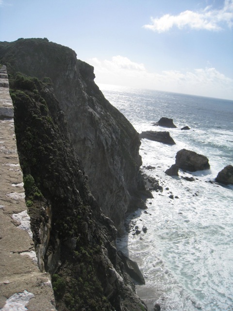
This photograph is taken from the granite nose of the cliff at the south end of Rocky Creek bridge. You can see that between here and the next granite nose the whole hillside above the highway has been sliding. Beyond the next bend and the north end of Bixby Bridge, the mountainside is sliding exactly the same way, too. You can tell by the re-vegetation that the sliding has been going on for a long time.
There is a photo circa 1950 looking southbound to the south end of Rocky Creek bridge that has this sign in it: "End Slide Area."
That is, this stretch of highway has been sliding virtually since it was built.
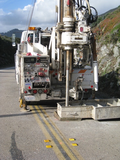
Geologists are drilling core samples at the slide, presumably to see how far down they have to go before they hit bedrock. A construction worker told me they're also checking saturation levels. He also said they're looking into temporary measures to get the road open as quickly as they can.
But that will mean carving back into an already active slide zone. Is the other question (being whispered?) whether to re-route this whole stretch of the highway?
The coast trail — and wagon road — probably had it right the first time.
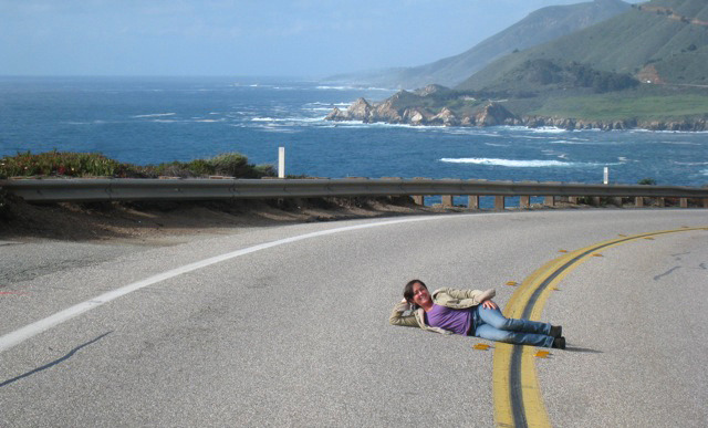
But in the meantime — until/unless pedestrians really are prohibited — at least on a sunny day...
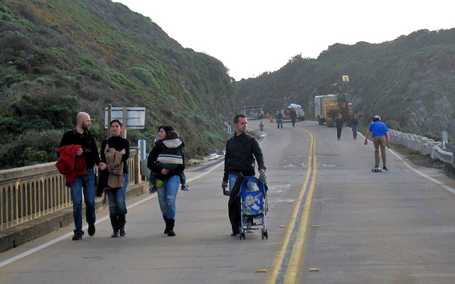
...the closed coast road can look a little like a promenade in Antibes.
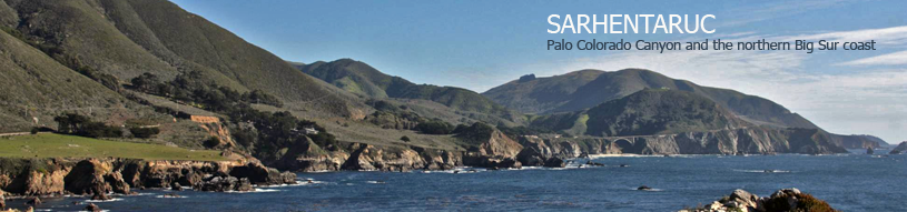
 The Coast-Road