SARHENTARUC JOURNAL

This journal focuses on the art, history, culture, and wildlands of the northern Big Sur coast. Periodic entries and documents appear at random here.

CURRENT MOON


This area does not yet contain any content.
SUBSCRIBE BY EMAIL

Enter your email address:

Delivered by FeedBurner

Entries in The Coast-Road (5)

Thursday
Apr212011

Not the asphalt ribbon of a highway...

Far and away the biggest single impact to this coast came in 1769 when the Portolá expedition came up this coast, skirting these mountains, but establishing the mission system. But after this event, the next biggest impact came with building the highway. It changed a homestead economy (and demographic) into a highway economy (and demographic).

But our life-line should not be the asphalt ribbon of the highway. It should be our humility and relationship with these wild mountains. If we're not careful, if we live within these screens too much — only peering out through our windows along the "scenic corridor" — we'll lose that connection, and inadvertently, even as we're saying how much we love it here, we could end up destroying the essential wild nature of this coast.

Ts'owém' (Cone Peak). John Peabody Harrington, October 1932. Courtesy of the National Anthropological Archives.                                            _____________________________

Note

Xasáuan Today is reporting one good prescription — National Trails Day on June 4 at Big Sur Station.

Thursday
Apr072011

Jaime de Angulo: "But my coast is gone, you see...The spirits would depart."

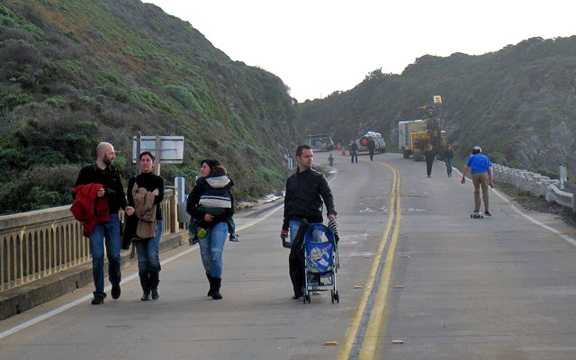
Jaime de Angulo came to the coast — on horseback — in 1915. No one's written of the sheer dizzying wildness of this coast like he has. Later in his life he wrote an account of his first experience with the coast — an account which remained untitled among his unpublished papers when he died.

But it's been published since, first under the title "La Costa del Sur" in A Jaime de Angulo Reader, and more recently as "First Seeing the Coast" in The Lariat and Other Writings.

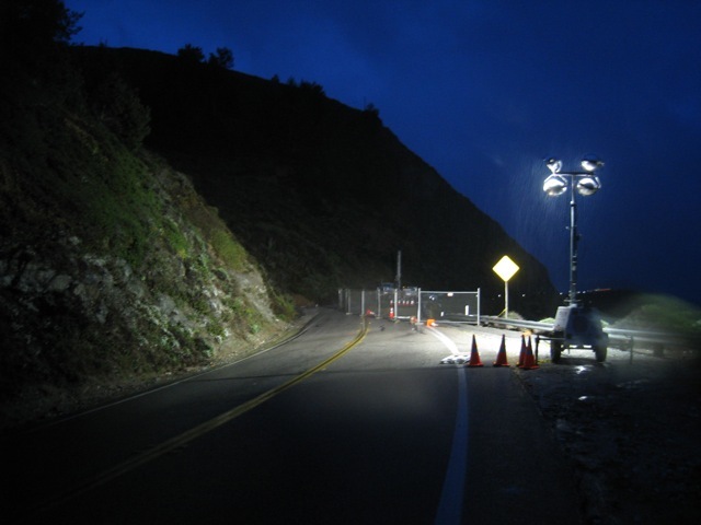
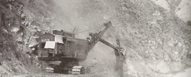
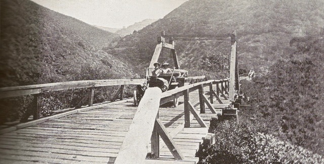
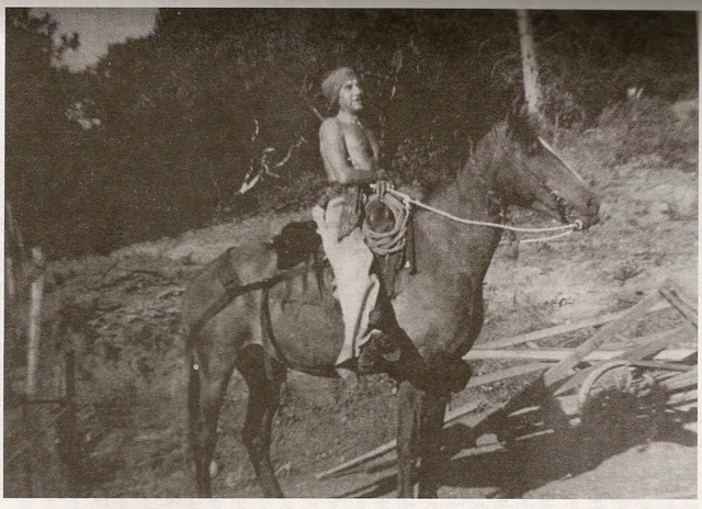
Jaime de Angulo on HudiniJaime was away from the coast for seventeen months in the early 1920's when he was doing linguistic work in Mexico — and when he returned in the winter of 1923, he was shocked to discover the highway being built.

Courtesy of the Ewoldsen family. Photo appears in "Big Sur" by Jeff Norman and the Big Sur Historical Society.The following are excerpts from a letter he wrote to his first wife, Cary Fink, on December 14, 1923.

"Meanwhile you can picture to yourself the fever on the Coast. People rushing down to buy land as if to a Klondike. All land gone sky high. Partington Cañon is sold to those people Chauncey wrote about, who formed a 'Trail Club' (and had started buying a piece near Post). But they are not at all a gun club, but people from Carmel, mostly, among them Mrs. Porter of the deep voice, who have formed a trust company and bought it to 'preserve the redwoods'...

"We had great fun out of them. They went away round eyed, ho-in and ha-in and talking 'building sites.' Rather nice people on the whole — and certainly infinitely better than a 'gun club' which is what I feared.

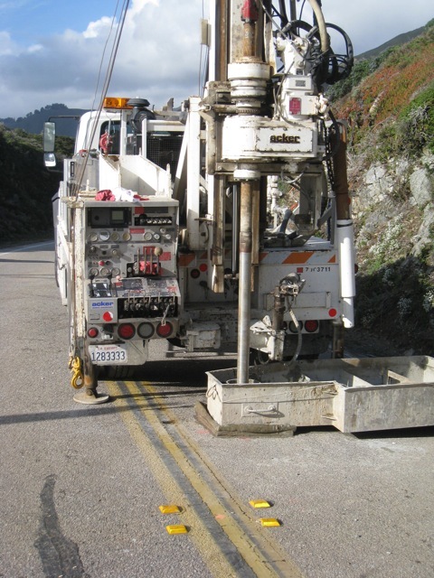
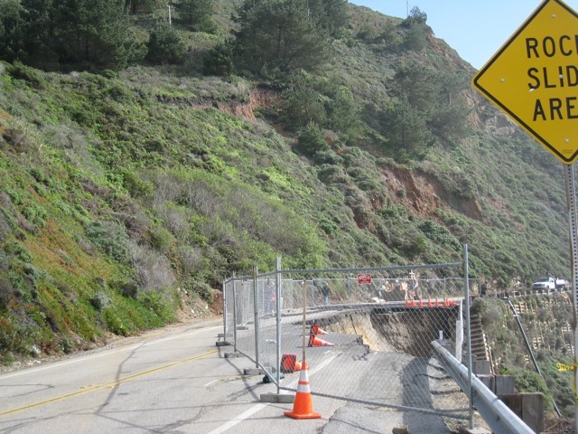
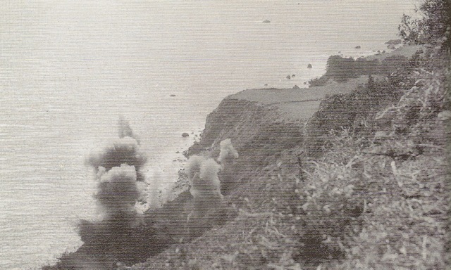
"But my coast is gone, you see. It will be an altogether different affair. I don't know what to think of it, on the whole. My first reaction of course was one of intense sorrow and horror. My Coast had been defiled and raped. The spirits would depart. And as I travelled with Mr. Farmer (the stage man) past Castro's place, past Grimes' cañon, and contemplated the fearful gashes cut into the mountain, and the dirt sliding down, right down into the water in avalanches, my heart bled."

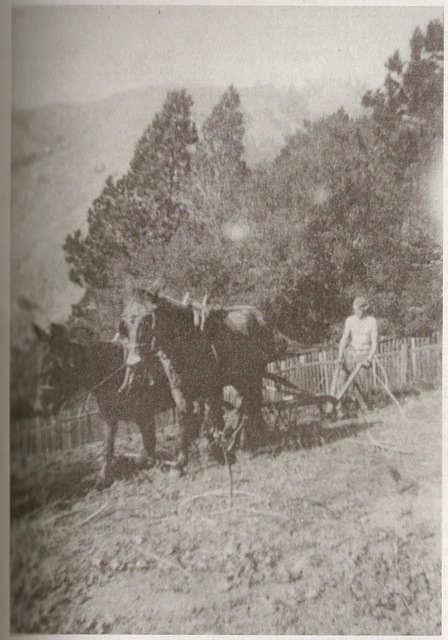
Jaime plowing at Los PesaresYears later, when Jaime wrote his account of coming to the coast, he described El Mocho — Roche Castro — leading him straight up a mountainside so steep that as skillful a horseman as Jaime was..."I must confess I got dizzy and had to get off my horse and lead him, much to the Mocho's amusement."

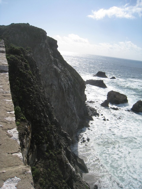
Roche was leading Jaime to a hillside sixteen hundred feet above the ocean, where Jaime would homestead the ranch he called "Los Pesares."

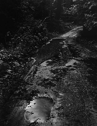
"What a scene! Yes, I lost my heart to it, right there and then. This is the place for a freedom loving anarchist. There will never be a road into this wilderness...it's impossible! Alas, nothing is impossible to modern man and his infernal progress: they came with bulldozers and tractors before very long, and raped the virgin. Roads and automobiles, greasy lunch-papers and beer-cans, and their masters. And the shy Masters of the Wilderness receded to the depths of the canyadas, and back over the Ridge, into the yet unraped country of the Forest Reserve — but even there they are not safe..."

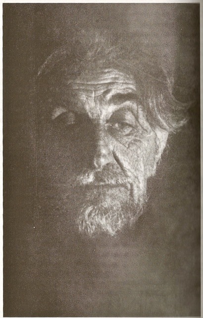
The "old coyote of Big Sur" in 1948I don't know what you make of these "shy Masters of the Wilderness," these spirits whom Jaime said would flee the building of the highway — but I take them seriously.

And there's no bigger question for this coast than what will become of them.

                                                 _______________________________

Notes

The three photos of Jaime de Angulo appear courtesy of Gui de Angulo's biography of her father, The Old Coyote of Big Sur: the Life of Jaime de Angulo.

The Old Coyote of Big Sur: the Life of Jaime de Angulo is available on-line and in person at The Henry Miller Library in Big Sur.
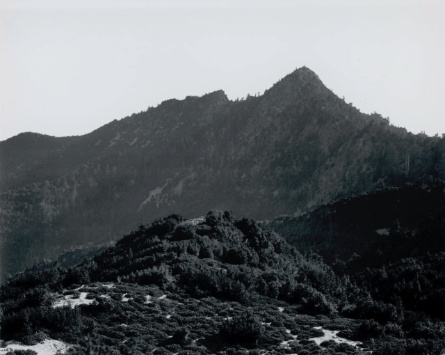
 

Sunday
Apr032011

Robinson Jeffers' "The Coast-Road"

At a time when the collapse of the highway can feel like disruption, it's good to remember that for many on the coast the real and permanent rupture came when the highway was built in the first place.

"Bridge in Rocky Creek Canyon" by Horace Lyons — in "Jeffers Country: The Seed Plots of Robinson Jeffers' Poetry."

The Coast-Road


A horseman high-alone as an eagle on the spur of the mountain over Mirmas Canyon draws rein, looks down
At the bridge-builders, men, trucks, the power-shovels, the teeming end of the new coast-road at the mountain’s base.   
He sees the loops of the road go northward, headland beyond headland, into gray mist over Fraser’s Point,
He shakes his fist and makes the gesture of wringing a chicken’s neck, scowls and rides higher.
                        
                                              I too
Believe that the life of men who ride horses, herders of cattle on the mountain pasture, plowers of remote
Rock-narrowed farms in poverty and freedom, is a good life. At the far end of those loops of road
Is what will come and destroy it, a rich and vulgar and bewildered civilization dying at the core,
A world that is feverishly preparing new wars, peculiarly vicious ones, and heavier tyrannies, a strangely
Missionary world, road-builder, wind-rider, educator, printer and picture-maker and broad-caster
So eager, like an old drunken whore, pathetically eager to impose the seduction of her fled charms
On all that through ignorance or isolation might have escaped them. I hope the weathered horseman up yonder
Will die before he knows what this eager world will do to his children. More tough-minded men
Can repulse an old whore, or cynically accept her drunken kindnesses for what they are worth,
But the innocent and credulous are soon corrupted.
                                                                              
                                                                       Where is our consolation? Beautiful beyond belief
The heights glimmer in the sliding cloud, the great bronze gorge-cut sides of the mountain tower up invincibly,   
Not the least hurt by this ribbon of road carved on their sea-foot.


Thursday
Mar242011

Wynn Bullock, "Palo Colorado Road" — 1952

This is one of my favorite images of old/new life in this canyon.

Could've been a hundred years ago. Could have been tonight.


Tuesday
Mar222011

"Road out just south of Rocky Creek..."


One thing about the coast highway collapsing is that it can carry you back into the road's history and give you a faint glimpse of what pre-highway life on the coast must have been like. No matter how economically dependent on the coast highway most residents now are, there is almost always a simultaneous sigh of relief as the road shuts down, and the coast, humanly speaking, becomes quieter and more inward — and more neighborly, too, as people are reminded of how ultimately dependent upon one another we still are.

That is, combined with economic worries, most of us also become deeply grateful for the reminder of why we're really here.

The coast trail, and then the wagon road, wound down into every canyon — and then climbed back out again. This is a view from standing on the current Rocky Creek bridge looking back upcanyon. The old wagon road used to run more or less at the contour of the current phone line. It then descended into the canyon and climbed up the saddle just below Division Knoll.

Courtesy Franklin Peace. Image appears in "Big Sur" by Jeff Norman and the Big Sur Historical Society (93).The above is one of the iterations of the wooden bridge across Rocky Creek. You can see that it crosses much upcanyon of the current concrete highway bridge.

But when the highway was built — since it was intended to be scenic — it hugged the coast (with the exception of the Big Sur river valley) no matter how vertical that coast was.

Courtesy Pat Hathaway. Image appears in "Big Sur" by Jeff Norman and the Big Sur Historical Society (96).

If this photo of a steam-shovel building Highway 1 wasn't taken at the exact spot of the current slide, it easily could've been. Notice a couple things in the photograph. First of all, notice the integrity of the slope above the road ahead of the steam-shovel compared to the slope above where it has already passed. Secondly, notice the side-casting being done. Jeff Norman's caption to this photograph includes this sentence: "Here, an operator side-casts the overburden, thus building up the outer edge of the roadway."

One thing that strikes you at the slide is how much of the highway here was built upon just such fill. Big Sur Kate reports that the cribbing you see dates back to "the original convict construction in the 30′s." I heard another report that it dates back to the 1980's — when this stretch was also sliding. (Xasáuan Today has posted on the 1983 slides in this same vicinity).

But whenever this cribbing was put in, it hardly seems well grounded.

And the posts for the guard railing pulled out as clean as toothpicks.

This photograph is taken from the granite nose of the cliff at the south end of Rocky Creek bridge. You can see that between here and the next granite nose the whole hillside above the highway has been sliding. Beyond the next bend and the north end of Bixby Bridge, the mountainside is sliding exactly the same way, too. You can tell by the re-vegetation that the sliding has been going on for a long time.

There is a photo circa 1950 looking southbound to the south end of Rocky Creek bridge that has this sign in it: "End Slide Area."

That is, this stretch of highway has been sliding virtually since it was built.

Geologists are drilling core samples at the slide, presumably to see how far down they have to go before they hit bedrock. A construction worker told me they're also checking saturation levels. He also said they're looking into temporary measures to get the road open as quickly as they can.

But that will mean carving back into an already active slide zone. Is the other question (being whispered?) whether to re-route this whole stretch of the highway?

The coast trail — and wagon road — probably had it right the first time.

But in the meantime — until/unless pedestrians really are prohibited — at least on a sunny day...

...the closed coast road can look a little like a promenade in Antibes.